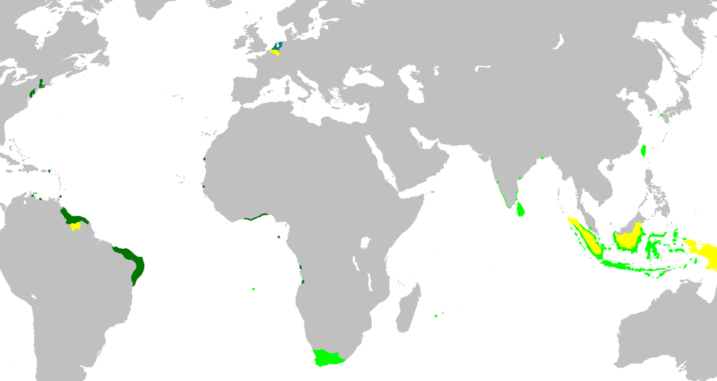
A map of the Dutch colonial empire.
Light green – territories administered by or originating from territories administered by the Dutch East India Company;
Dark green – the Dutch West India Company
Yellow – are the territories occupied later, during the 19th century.

You must be logged in to post a comment.